[ad_1]
Hurricane Ian is expected to bring heavy rain, strong wind, and life-threatening storm surge to Florida’s Gulf Coast as the storm moves closer.
Visit the FOX Weather Wire for live updates on Hurricane Ian as it barrels toward Florida. Click here for the latest forecast, evacuation orders and more.
TAMPA, Fla. – New photos using the latest forecast data from the National Hurricane Center paint a daunting picture of how severe storm surge flooding could inundate heavily-populated areas in the direct path of Hurricane Ian this week.
Hurricane Ian is currently a Category 3 storm in the Gulf of Mexico, but is expected to grow into a Category 4 storm by the time it reaches Florida’s west coast.
One of the main dangers Ian poses is an extreme storm surge. The FOX Forecast Center predicts life-threatening storm surges of up to 3 and 10 feet.
HOW TO WATCH FOX WEATHER
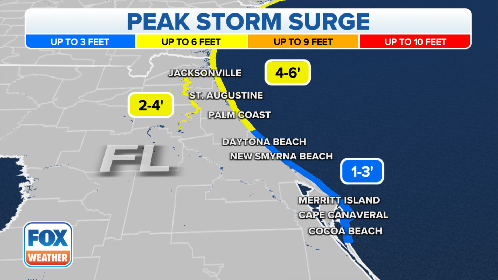
(FOX Weather)
The National Hurricane Center released a worst-case inundation forecast that expects several feet of flooding around Tampa, Port Charlotte, Punta Gorda and Fort Myers.
Using Google Earth, FOX Weather has produced these maps showing should the NHC storm surge worst case scenarios come true, this is what it could look like:
Tampa
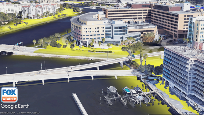
A model of the Tampa General Hospital Campus. The areas highlighted in yellow can see up to six feet of flooding.
(Google Earth / FOX Weather)
The area surrounding the Tampa General Hospital campus could see up to 6 feet of inundation.
Port Charlotte
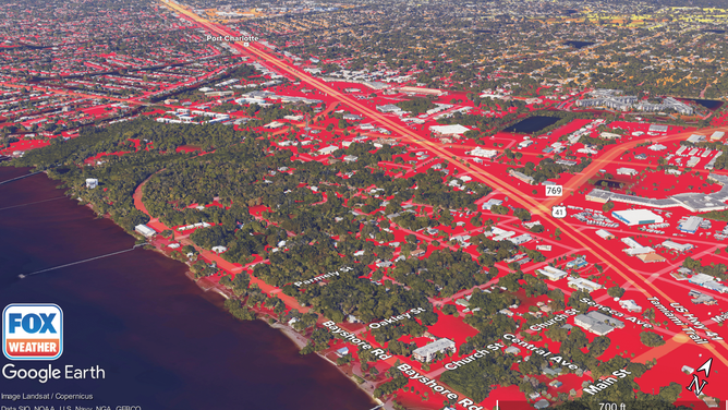
A model of the city of Port Charlotte. The areas highlighted in yellow may see up to 6 feet of flooding. Areas in orange may see up to 9 feet of flooding. Areas in red may see over 9 feet of flooding.
(Google Earth / FOX Weather)
Located south of Tampa, Port Charlotte is home to around 50,000 people. The city’s grocery stores, schools, churches, and homes could be covered with at least 9 feet of water.
Punta Gorda
A model of Punta Gorda. The areas highlighted in orange may see up to 9 feet of flooding. The areas in red may see over 9 feet of flooding.
(Google Earth / FOX Weather)
Punta Gorda lies south of Port Charlotte. Like Port Charlotte, Punta Gorda sits on a bay and may also be covered by at least 9 feet of water.
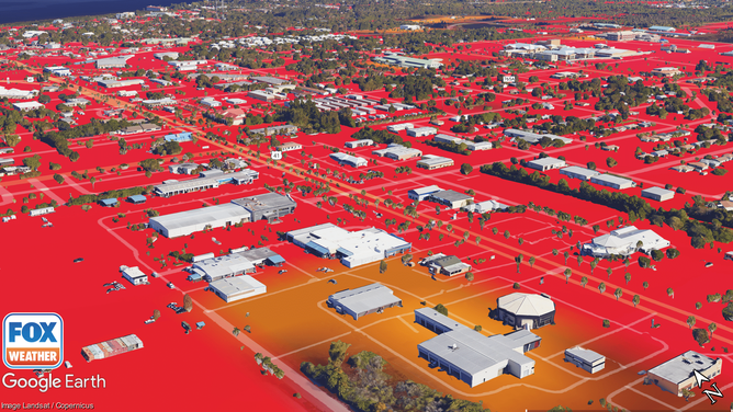
Fort Myers

The River District of Fort Myers. The areas closest to the river may see over 9 feet of flooding.
(Google Earth / FOX Weather)
Further south along the coast is Fort Myers. The River District in Fort Myers, in particular, is a lively hub with entertainment and nightlife, but also things like libraries, churches and businesses. It, too, can see as much as 9 feet of water or more under worst-case conditions.
[ad_2]